

Why Monroe? Our Accessibility.
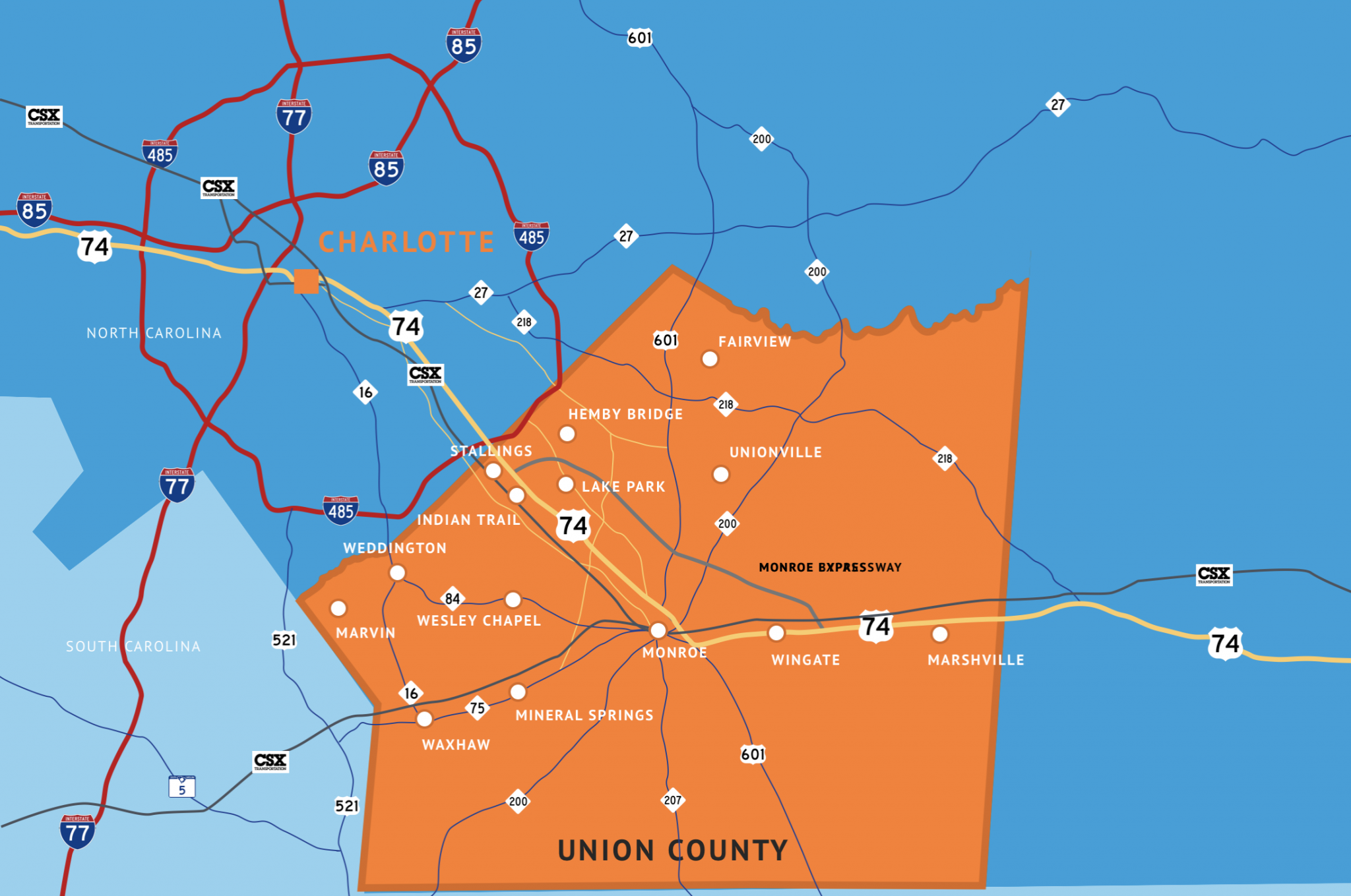
Highways & Interstates
1 minutes to 40 minutes
30 minutes to 75 minutes
30 minutes to 75 minutes
90 minutes
1 minute to 15 minutes
Under construction
Road
I-485
I-85
I-77
I-95
US-74 Expressway (Toll)
I-73/74
Average Drive Time
Airports
Charlotte-Monroe Executive Airport Customs service available
Charlotte-Douglas International Airport
Concord Regional Airport
0 minutes
25 minutes
20 minutes
Wilmington, NC
Charleston, SC
Morehead City, NC
Savannah, GA
Norfolk, VA
Port
Distance
160 miles
230 miles
265 miles
265 miles
339 miles
Average Drive Range
Airport
Ports
Railroad

CSX has three main lines that converge in a medium-sized switchyard in the City of Monroe with access to the ports of Wilmington and Charleston and the Intermodal yard in Charlotte. There are approximately 300 miles of rail in Union County.